REMOTE SENSING
In keeping up with trends in the wind industry, CCR offers innovative, portable, and cost-effective remote sensing systems in the United States and Canada. We are proud to be the first re-seller of the Fulcrum3D SODAR in the North American market. We service the entire remote sensing deployment process, from choosing a location to installation, data collection, maintenance, and relocation.
Fulcrum3D SODAR
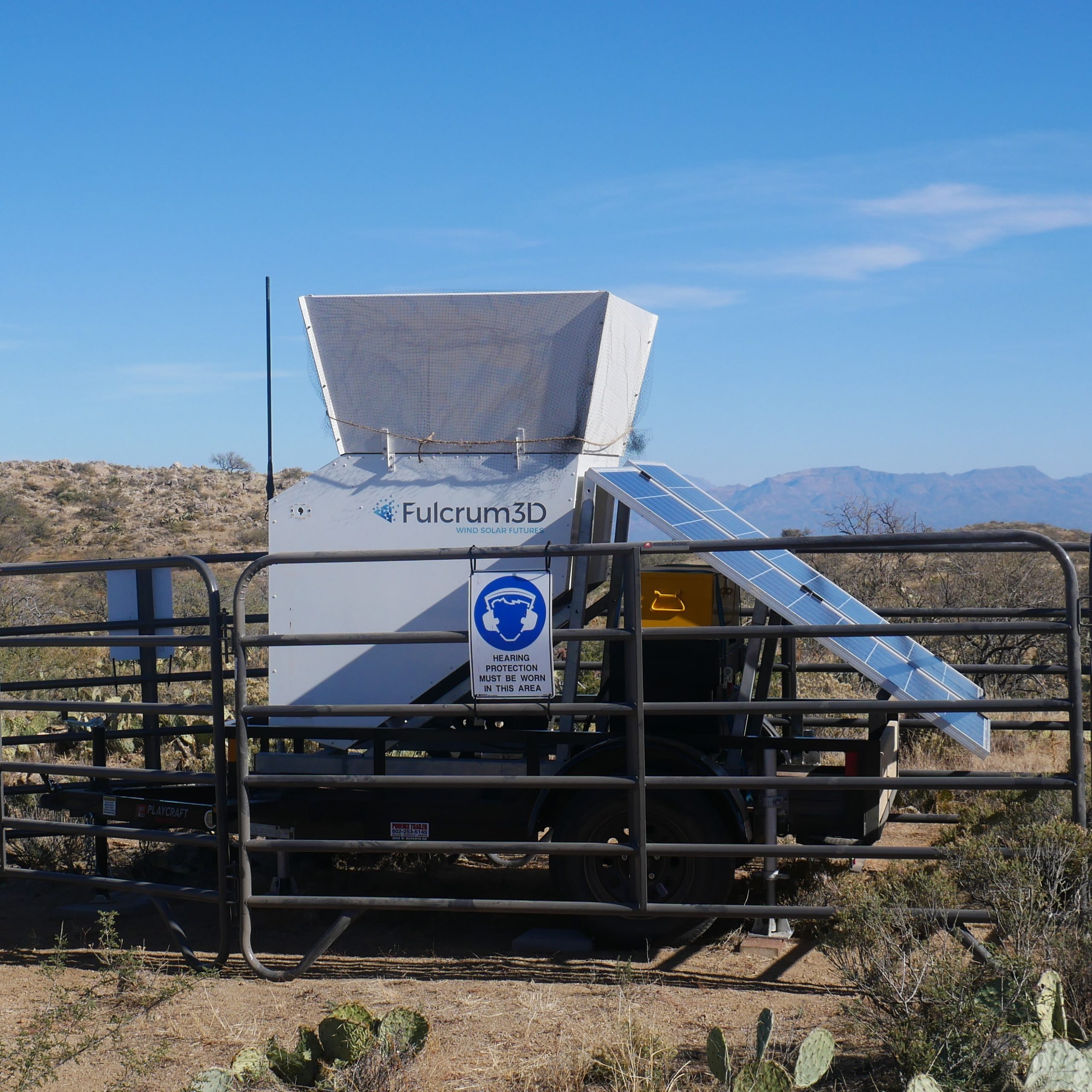
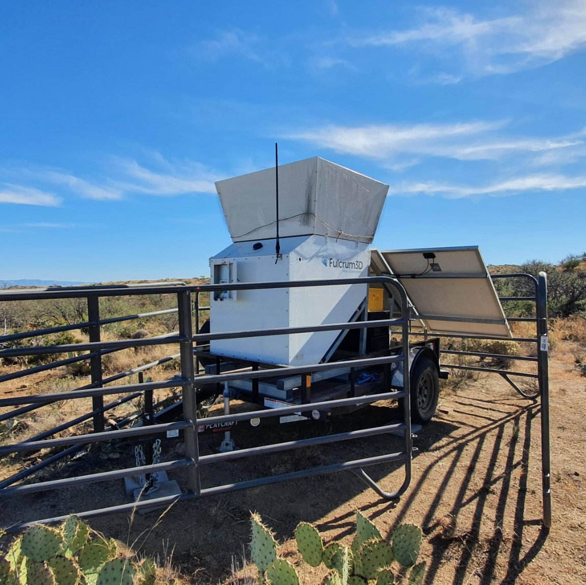
CCR became the first reseller of the Fulcrum3D SODAR in the North American market in 2022. We are excited to bring this rugged and cost-effective SODAR technology to North America for wind measurements up to 200 meters.
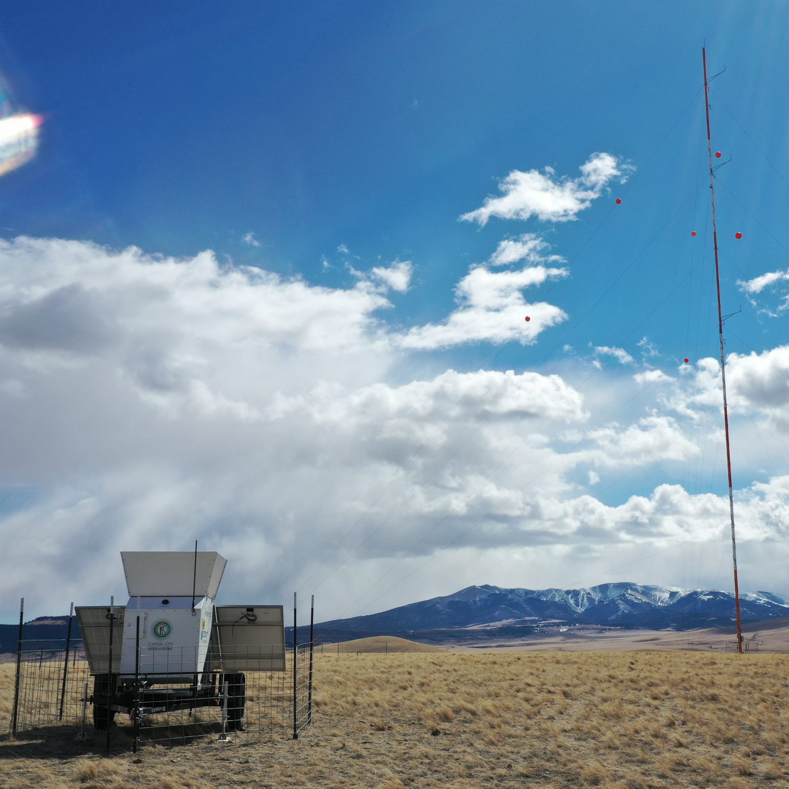
The Fulcrum3D SODAR has been used in Australia and the Asia-Pacific market for years, and has proven to be a reliable wind data collection device. The SODAR is designed for all stages of wind resource campaign, including greenfield assessment, met tower co-location, and standalone deployment. The SODAR is trailer-based, offering quick and easy relocation. Advanced frequency tuning allows for echo mitigation and higher data recovery. Data collection is cloud-based through Fulcrum3D’s FlightDECK service.
CCR offers the Fulcrum3D SODAR for sale or rental, and we can support all stages of field deployment, from transport to site, installation, maintenance, and relocation. With the Fulcrum3D Australian team, we are building a support network for the SODAR in the North American market.
Other Remote Sensors
Designed to capture wind data from 20 to 200-meters in height, the SpiDAR Wind LiDAR is known for accuracy and ease of use. This technology is recommended to remove wind resource assessment uncertainty and is a cost effective LiDAR solution for wind energy projects. Now administered in the US by NRG Systems, CCR has one SpiDAR unit for rental and can install, maintain, and relocate customers’ SpiDARs as well.
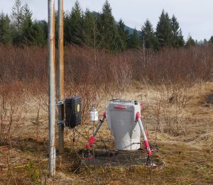
The ZX 300 LiDAR, manufactured by ZX Lidars, is known for accuracy, capturing the vertical wind profile from 10m to 200m. This technology can be employed for both power performance testing and pre-construction wind resource campaigns. Serviced and distributed in the US by NRG Systems, and CCR can assist customers with procurement and field services, including installation, maintenance, and relocation for the ZX 300 LiDAR.
The WindCube V2 LiDAR is known for accuracy, capturing the vertical wind profile from 40m to 200m. This technology is often employed for power performance testing, but can also be used for pre-construction wind resource campaigns. Vaisala has taken up the servicing and distribution platform for the WindCube, and CCR can assist customers with procurement and field services, including installation, maintenance, and relocation, for both the WindCube V1 and V2.
The Triton Sonic Wind Profiler, originally manufactured by Second Wind, was supported and distributed by Vaisala in the latter half of the 2010s until the program was discontinued. This popular and cost-effective SoDAR can measure the wind profile between 40m and 200m, and offers easy relocation when mounted on a trailer. CCR can support customers’ existing Triton SoDARs with field maintenance, winterizations, and relocations as Vaisala winds down the program.
Remote Sensing Services
We work with Fulcrum3D to offer sales and rental of Fulcrum3D SODAR for developers, owners/operators, and consultants in the North American market. We can also work with your company to assist with the procurement of other remote sensing technologies.
CCR can transport to site, install, maintain, service, winterize, and relocate SODARs and LiDARs across the United States and Canada. We have years of experience completing these tasks in harsh climates and complex terrain, all while ensuring the units have enough remote power capacity for off-grid sites.
We understand how remote sensing placement and remote power supply can be managed to provide the highest data recovery rates for remote sensing technology. We monitor and assess remote sensing data to ensure the best data recovery rates and high quality wind assessment campaigns.
The Fulcrum3D SODAR streams collected wind data to Fulcrum3D’s FlightDECK online cloud platform. CCR can support customers with this platform, and monitor the incoming data to ensure high data recovery. CCR can also support data collection for other remote sensing technologies as well.
Need to take your data to the next step? CCR can clean and validate met tower and remote sensing data and perform energy yield analysis and layout design with the cleaned data. Designed to help wind developers operate more profitable wind farms, industry standard CFD modeling software is used for projects in complex terrain. This software helps maximize wind farm energy production with the highest wind speeds and lowest turbulence.
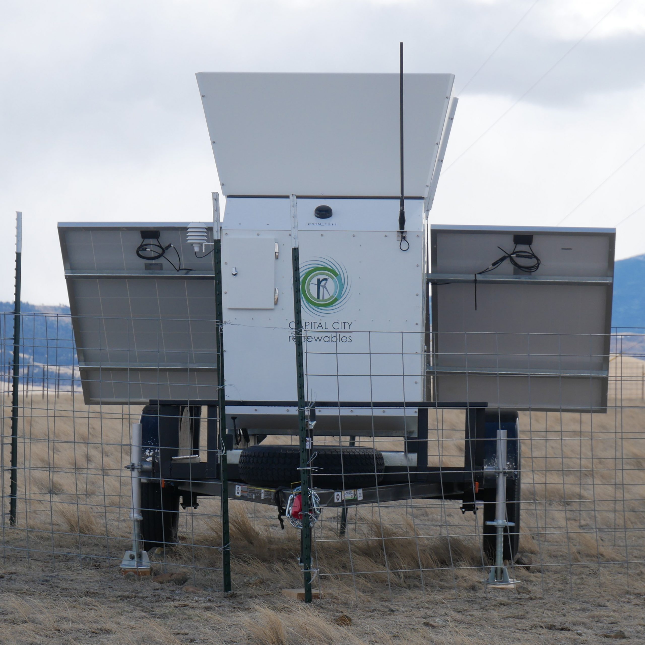
The Fulcrum3D SODAR allows for additional meteorological measurements to be taken with installed sensors on the unit. This includes temperature & relative humidity (included on the base model), pressure, rainfall, irradiance, soiling, and others. Perhaps you would like to conduct a combination wind/solar resource measurement campaign at one site; the modular nature of the Fulcrum3D SODAR’s data logger makes it possible to add a pyranometer.
For sites without easy access to power, our custom solar power stations are a great solution. CCR can design a power station that supplies the power necessary to run LiDAR equipment with minimal to no downtime, even in the coldest of climates. CCR’s power stations have the option of remote connectivity, allowing the user to monitor temperatures and battery levels, and manually trigger the diesel generator in parallel with the pre-programmed thresholds.
Hub-height wind data is often necessary for most wind energy projects to move forward. Remote sensing plays a valuable role for projects with shorter met towers, offering hub-height wind measurements at co-located met towers or freestanding locations. Moreover, the unique portability of remote sensing devices allow for many hub height measurements taken at different locations around the project in sub-year intervals.
CCR works with developers, landowners, and stakeholders to assess the level of security needed for remote sensing devices in each particular location, and can install the necessary fencing, locks, and other anti-theft/vandalism devices to protect the unit.
Do you want to bring years of wind energy assessment experience to your next project?


